This is without doubt the toughest climb in this guide. This is the challenge that will graduate you from an aspiring scrambler to an accomplished one. There are countless kilometres of deadfall to climb over, bushwhacking to endure, route-finding to navigate, a boulder field to crawl over and a stream to splash across. But the best prize of this challenge is 1000 m of the nastiest scree you have ever encountered. This could possibly be the most exhausting day of your life.
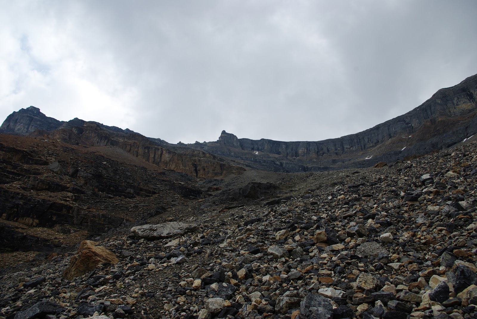
Upper scree slope
ELEVATION GAIN: 1521 m
Storm Mountain Trailhead:
GPS: N51 13 06.1 W116 03 25.7
Elevation: 1644 m
Storm Mountain Summit:
GPS: N51 12 27.6 W116 00 17.9
Elevation: 3165 m
Trailhead: From the crossroads of the Trans-Canada and the Banff–Windermere highways (Hwys. 1 and 93), travel south for 11.4 km to a small gravel pull-off on the east (left) side of the highway. This is readily recognized, as there is a steel gate inside the pull-off. This parking area is 1.2 km south of the Continental Divide marker, also on the east side of the parkway. The Continental Divide point of interest is 10.2 km south of Castle Junction.
Past the thick brush, the way opens to the horrific remnants of the 2003 forest fire season and the repetitive deadfall that must be climbed over. This alone becomes exhausting after the first 40 or 50 of these natural obstacles. The stream remains on your right as the trail ventures upward through burnt forest with green undergrowth. Stick close to the stream while searching for a faded track. It is there, so keep an eye out as you continue upward, because about 20 minutes into the trek you’ll find a stack of cairns approximately knee high close to the stream. This marks the beginning of the recognizable trail.
From the cairns, the trail begins a five- to ten-minute ascent of switchbacks, eventually leveling off and leaving the stream below. After about five minutes of flat walking, the climbing resumes again. As the path weaves upward through the scorched forest, the obstacle course of fallen trees becomes quite tiresome. Over, under and around. Roughly another 20 minutes later, the forest begins to thin, the trees begin to shorten, and luckily the grade of the slope begins to decrease. Another ten minutes of bashing around deadfall, and the trail and the stream meet once more. Continue to follow the indistinct path for another 15 minutes as it tries its best to stay beside the stream, and you will be rewarded again by hurdling over more trees that are downtrodden.
Elevation: 1644 m
Storm Mountain Summit:
GPS: N51 12 27.6 W116 00 17.9
Elevation: 3165 m
Trailhead: From the crossroads of the Trans-Canada and the Banff–Windermere highways (Hwys. 1 and 93), travel south for 11.4 km to a small gravel pull-off on the east (left) side of the highway. This is readily recognized, as there is a steel gate inside the pull-off. This parking area is 1.2 km south of the Continental Divide marker, also on the east side of the parkway. The Continental Divide point of interest is 10.2 km south of Castle Junction.
Walk around the steel gate, follow the road and immediately enter a large field. Stroll through the middle of it and make your way to the far left end. Here there is a short, narrow gully taking you down to a stream that is barely too wide to step across. A makeshift bridge of old logs is apparent but slippery. Be careful. Waist-high brush presents the first obstacle for a trail-less beginning.
Past the thick brush, the way opens to the horrific remnants of the 2003 forest fire season and the repetitive deadfall that must be climbed over. This alone becomes exhausting after the first 40 or 50 of these natural obstacles. The stream remains on your right as the trail ventures upward through burnt forest with green undergrowth. Stick close to the stream while searching for a faded track. It is there, so keep an eye out as you continue upward, because about 20 minutes into the trek you’ll find a stack of cairns approximately knee high close to the stream. This marks the beginning of the recognizable trail.
From the cairns, the trail begins a five- to ten-minute ascent of switchbacks, eventually leveling off and leaving the stream below. After about five minutes of flat walking, the climbing resumes again. As the path weaves upward through the scorched forest, the obstacle course of fallen trees becomes quite tiresome. Over, under and around. Roughly another 20 minutes later, the forest begins to thin, the trees begin to shorten, and luckily the grade of the slope begins to decrease. Another ten minutes of bashing around deadfall, and the trail and the stream meet once more. Continue to follow the indistinct path for another 15 minutes as it tries its best to stay beside the stream, and you will be rewarded again by hurdling over more trees that are downtrodden.
Now the forest opens to a magnificent long
boulder field situated right in the gully you’ve been hiking in as it
approaches the base of the mountain. Looking upward to the right, the source of
these large boulders becomes obvious. Different obstacles must now be
negotiated as deadfall and brush give way to large rocks and massive boulders.
The rockhopping begins about 90 minutes into this demanding journey. Initially
contained inside the boulder gully, the path stays close to the forest on your
left, but as the gully expands, the necessity of crossing this minefield of
oversized rocks becomes apparent. Watch for another gulch that enters yours,
roughly 20 minutes into the boulder field. From this point, make your way to
the right, over huge rocks the size of cars. It’s quite fun, actually, once you
establish a rhythm. Not so much fun when the lichen-laden rocks are wet,
though, so be careful.
Believe
it or not, accomplishing the boulder crossing has only put you in position to
scramble up 900–1000 m of horrible, horrible, horrible scree. You have
been warned, so please do not curse me out halfway up. In all of our
discussions with fellow scramblers, when Mount Storm comes up, it is immediately
dismissed as the one that everyone is putting off. The rumours of this scree
slope are legendary. And, yes, they are true.
The
remainder of the hike is a trudge upward on a giant slope of rocks, pebbles,
stones and gravel. Upward is obvious, but there is a best route to follow. As
you enter the talus slope, you will see a path that has been traced by the
drudgery of others. Continue up the belly of the slope looking for a couple of
prominent rock bands several hundred metres up. Stay to the right of these,
eventually crossing over the top of them and moving to the left. As you cross
leftward over the top of these rock bands, a cliff face is now on your right.
Ultimately, you will bypass this by staying left and continue straight up
again. As the false summit comes into view you’ll easily see a large cairn
slightly to the left. Direct yourself toward this cairn.
At some point you will need to ascertain
your position on a mountainside of sliding rock that is simply working you to a
state of fatigue. Stop. Take many breaks. Look behind you and enjoy where you
are. Gaze out and realize, as you look down at the highway, just how lucky you
are. Watch the traffic whiz by, and become aware of your surroundings. You are
one of less than one tenth of one tenth of one per cent of travellers that
actually get out and do this. Then turn around and get back to work.
The
route-finding really is not that difficult; just make sure you follow the
trails on the scree to avoid heading into a dead canyon. From the cairn, the
summit is still another 250 m up, but as the ascent continues, the grade
decreases. Finally you begin to walk on reasonably level ground to approach the
true summit over to your right.
Mount
Ball’s fantastic snow-covered peak, 6 km to the south, appears to hang
over the summit of Storm Mountain, and with an apex of over 3300 m, it is
incredibly impressive. To the west are Mount Whymper and Boom Mountain.
No comments:
Post a Comment